[ad_1]
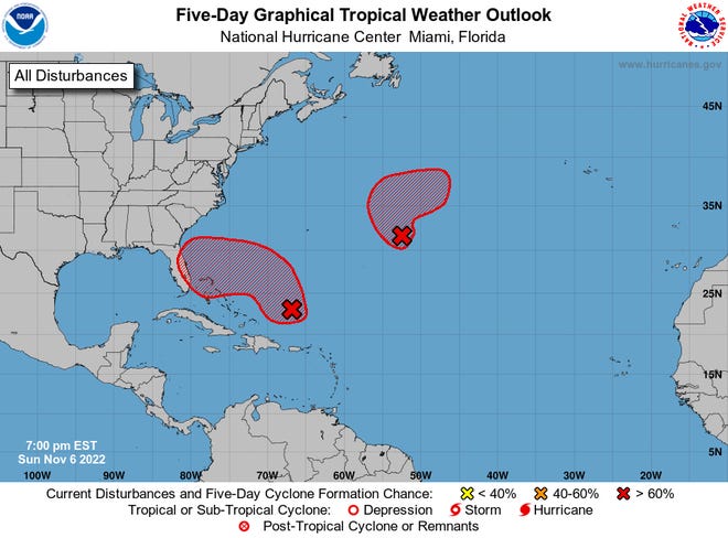
After several years of tweaking and verification, the National Hurricane Center will extend the time frame on its potential storm formation outlooks from five days to seven days, starting with the new season.
The extension is one of several tweaks the Hurricane Center announced Friday, a timely reminder to start preparing for hurricane season.
The season begins May 15 in the eastern Pacific Ocean region and June 1 in the Atlantic Ocean region. Daily outlooks also begin on May 15, just six weeks away.
Regardless of whether it’s a busy or slow season, it only takes one hurricane to change your life.
Think your home is safe from hurricanes?:Not so fast. New report predicts growing risks.
How will the tropical outlook change?
The hurricane center issues its tropical weather outlook every six hours throughout the day during the season, explaining the potential for any tropical waves and areas of disturbed weather to develop into tropical cyclones.
In recent years, the outlook indicated the chance of tropical storm formation at two days and five days. Starting this season, it will show the chances of formation at two days and seven days.
The Hurricane Center has been internally testing the accuracy of a seven-day outlook for several years, said Robbie Berg, acting chief of the center’s hurricane specialist branch. “Our reliability of that seven-day forecast is just as good as our five-day forecast has been.”
How does climate change affect you?: Subscribe to the weekly Climate Point newsletter
READ MORE: Latest climate change news from USA TODAY
Such a long-range forecast period might have been unthinkable even 20 years ago.
“When I started at the hurricane center in 2002, we were only doing a two-day formation forecast,” Berg said. “We’ve pushed it out to seven days, which is a pretty big leap.”
He attributes that to several things:
- The numerical models that simulate cyclone formation have improved.
- Forecasters have gained more confidence in the models
- Better satellite imagery that allow them to see weather patterns.
Because the range is extending to seven days, Berg said the potential area where the map shows the storm may form could show up larger than in the past

What are the other new changes from the Hurricane Center?
- They’re removing the “experimental” label from the peak storm surge forecast that gives people an idea of how much water could inundate their coastline in the Atlantic hurricane basin.
- The potential storm surge flooding map — illustrating the areas where inundation could occur and how high it might be above ground — is being expanded to include Puerto Rico and the U.S. Virgin Islands.
- Adjustments also were made to another hurricane center product — the tropical cyclone track forecast error cone — for both the Atlantic and North Pacific basins. While the cone remains about the same in the Atlantic, the size of the track error was reduced slightly for days 3 – 5 for the Pacific.
What is the track forecast error cone?
The often misunderstood cone in a track forecast represents only the probable future location of the center of a tropical cyclone.
It’s drawn by picturing imaginary circles that illustrate two-thirds of the forecast errors over the previous five years. The two-third probability circles for this year in the Atlantic include 26 nautical miles at 12 hours; 39 nautical miles at 24 hours and 67 nautical miles at 48 hours.
Impacts from a hurricane, such as storm surge, rainfall and even wind, can take place far outside the cone of uncertainty, particularly with very large systems.
Cone of Uncertainty:Many people misunderstand this famous hurricane forecast graphic. It can be a deadly mistake.
Were forecasts for Hurricane Ian wrong?:What experts say about the ‘cone of uncertainty.’
What will the forecast will be for this season?
The pioneering seasonal forecast from Colorado State University is expected on April 13. The latest forecasts for El Nino, which show a 64% chance of an El Nino by the peak of hurricane season between August and October could be good news for the hurricane battered Atlantic region.
Colorado State’s lead forecaster Phil Klotzbach tweeted recently. El Nino typically reduces the number of potential hurricanes because it increases vertical wind shear, which tends to tear apart the cloud tops that build powerful hurricanes.
The National Oceanic and Atmospheric Administration’s seasonal outlook will be released later in the spring.
Accuweather released its seasonal forecast this week, calling for a less busy season than in recent years with 11-15 named storms. An average hurricane season is 14 named storms.
What are this year’s hurricane names in the Atlantic?
Arlene, Bret, Cindy, Don, Emily, Franklin, Gert, Harold, Idalia, Jose, Katia, Lee, Margot, Nigel, Ophelia, Philippe, Rina, Sean, Tammy, Vince and Whitney
What remains outstanding from last hurricane season?
The final report on Hurricane Ian.
Ian is blamed for at least 151 deaths, primarily from its massive storm surge of up to 15 feet and historic rainfall across Florida. Ian caused more than $112 billion in damages, becoming the costliest hurricane in Florida history and the third costliest in U.S. history.
Ian was one of two names to be retired from the naming catalogue by the World Meteorological Organization this year. The other was Fiona.
Is climate change fueling hurricanes:Here’s what scientists say
Where can you see a Hurricane Hunter Aircraft?
The center’s annual Hurricane Awareness Tour will take place in the first week of May along the hurricane-prone Gulf of Mexico coast during NOAA’s annual hurricane preparedness week. The tour stops at local airports typically include a couple of Hurricane Hunter airplanes and staff and hurricane center personnel.
The following stops are scheduled this year:
- May 1 – Houston, Texas
- May 2 – New Orleans, Louisiana
- May 3 – Jackson, Mississippi
- May 4 – Tallahassee, Florida
- May 5 – Marathon Key, Florida
[ad_2]
Source link


