


[ad_1]
More severe storms and winter weather are expected to continue Monday as the first full week of April rolls on.
Over 4 million people are under winter storm warnings and 36 million people under frost advisories, according to the National Weather Service, while blizzard warnings blanketed parts of the northern Plains. Strong winds are also possible from Southern California through Michigan.
The South is also continuing to recover from a surge of storms that resulted in confirmed or suspected tornadoes in at least eight states, resulting in 27 deaths with more storms on the way.
“A very impactful period of weather is forecast throughout much of the nation into the early part of the first full week of April,” the NWS said.
Here’s what to know about the national weather forecast:
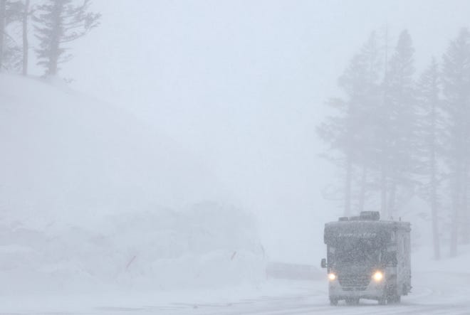
Rockies to get heavy snow
The Pacific Northwest began to see snowfall over the weekend, as a winter storm will move across the central and northern Rockies and drop heavy snow Monday morning and afternoon.
“A few feet of snow is possible across the higher terrain of Utah, Colorado and Wyoming, with lower elevations also seeing heavy snowfall amounts up to a foot,” the NWS said.
The affected areas could have difficult to impossible driving conditions Monday.
‘Biggest snowstorm of the year’ sparks blizzard warnings in Dakotas
The storm is likely to create blizzard effects Monday night, “setting the stage for what could be the biggest snowstorm of the year across parts of the northern Plains.” AccuWeather said wind gusts could reach up to 60 miles per hour, with NWS adding wind chills below zero “could be life-threatening to anyone stranded outdoors.”
“This next storm will be a classic spring blizzard,” said AccuWeather senior meteorologist Joe Lundberg.
Blizzard warnings were issued across much of the Dakotas and into northern Nebraska and eastern Wyoming. The warnings were set to begin Tuesday morning and last through at least Tuesday night in many areas.
Freezing rain is possible in:
- Eastern South Dakota
- Central Minnesota
- Northern Wisconsin
- Northern Michigan
Previously:Death toll at 32 after tornadoes hit South, Midwest, East; more possible this week


Tornado watch issued in recovering South
Severe thunderstorms and flash flooding were forecasted Sunday across parts of the southern Plains and Lower Mississippi Valley as the region recovers from a swarm of tornadoes that hit last week.
While the weather will be milder Monday compared to last week, it’s expected to ramp up Tuesday with 17 states at risk of severe weather and tornadoes, AccuWeather said.
A tornado watch was issued Monday morning for parts of the Florida panhandle, Alabama and Mississippi, set to expire at 12 p.m. ET/11 a.m. CT.
Other states at risk are:
- Arkansas
- Missouri
- Illinois
- Indiana
- Iowa
Portions of these states are also at risk:
- Texas
- Louisiana
- Mississippi
- Alabama
- Tennessee
- Kentucky
- Kansas
- Nebraska
- Minnesota
- Wisconsin
- Michigan
- Ohio
Tornado season:Here’s how to prepare your home
Winter storm tracker
National weather radar
Follow Jordan Mendoza on Twitter: @jordan_mendoza5.


[ad_2]
Source link