


[ad_1]

Blizzard conditions, wicked winds and possible tornadoes were expected to cause havoc across much of the nation Tuesday from the West Coast to the Southeast.
Meteorologists were especially concerned about dangerous overnight tornadoes in the central U.S. and warned residents to have shelter ready before going to sleep.
“This could be a night to just set up down in the basement to be safe,” said Tom Philip, a meteorologist in Davenport, Iowa.
Storms began Tuesday morning in the Midwest. Strong thunderstorms swept through the Quad Cities area of Iowa and Illinois with winds up to 90 mph and baseball-size hail. No injuries were reported but trees were downed and some businesses were damaged in Moline, Illinois.
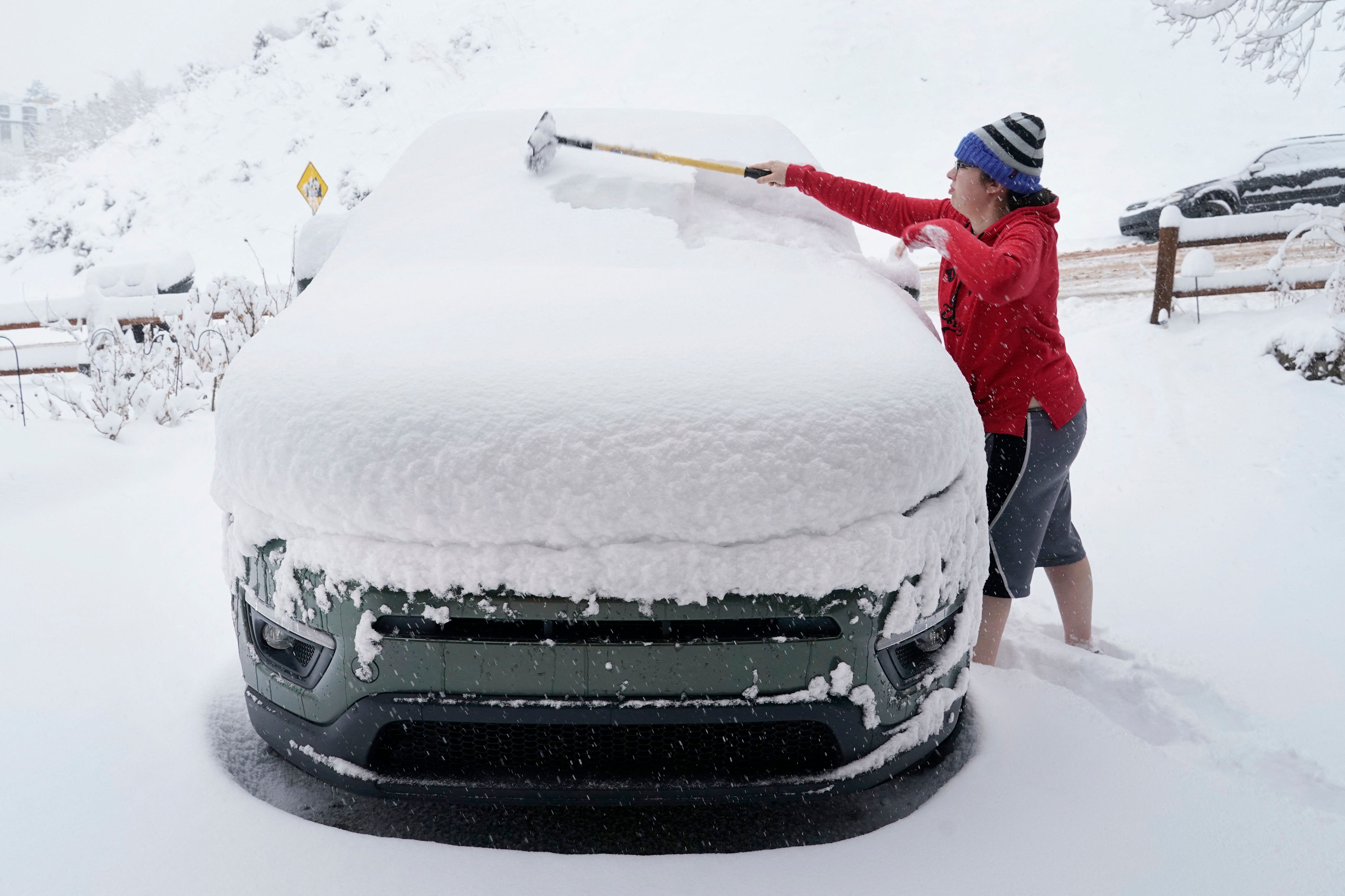
Blizzard warnings also blanketed parts of the West, northern Plains and upper Midwest, and nearly 3 feet of snow was possible in some places in what the National Weather Service’s Weather Prediction Center called “an impressive late-season winter storm.”
Meanwhile, fierce winds were expected across a stretch of the country from California to Missouri, and some gusts were forecast to reach up to 80 mph, possibly helping fuel and fan any wildfires that ignite.
In addition, by Tuesday afternoon, more than a dozen states will be at risk for severe weather and tornadoes. Some of those severe storms were forecast in areas where residents are still recovering after tornadoes last week left 32 people dead and wiped out whole communities.
Here’s what you need to know about Tuesday’s weather forecast:
IS A TORNADO WATCH OR WARNING WORSE? What to know about preparing for these violent storms
WHAT DEFINES A BLIZZARD? Heavy snow and high winds expected to sweep across country.
Blizzard conditions, wintry weather expected from Nevada to Michigan
The storm was expected to produce below-zero wind chills in the northern Plains, which “could be life-threatening to anyone stranded outside,” the weather service warned.
Dozens of schools in South Dakota were closed on Tuesday due to blizzard conditions. State executive branch offices were also closed in much of the state.
But even in areas where blizzard conditions weren’t likely, snow was forecast to cover parts of the country from Nevada to Michigan.
The snow that buried Casper, Wyoming, on Monday was a record-breaker, the weather service reported. The 26.7 inches of snow was the city’s all-time daily snowfall record.
In Michigan, a mix of snow, freezing rain and sleet was expected by Tuesday night. Farther south, a flood watch formed a band across the state because of the threat of excessive rainfall, according to the weather service in Grand Rapids.
Expected snow accumulations and wind gusts Tuesday:
- Nebraska and Wyoming: Blizzard warning in portions of the states, with up to 2 feet of snow and 50 mph wind gusts.
- Parts of South Dakota: Up to 30 inches of snow. Rapid City could see up to 24 inches.
- North Dakota: Blizzard conditions, up to 9 inches of snow and 55 mph wind gusts.
- Parts of Minnesota: Up to 19 inches of snow accumulation and 50 mph winds.
Winter storm map
Severe thunderstorms threaten Plains, Mississippi Valley
Showers and severe thunderstorms were forecast in the Plains and Mississippi Valley, the Weather Prediction Center said. Officials said there was a “moderate risk” of severe thunderstorms from Tuesday into Wednesday morning, which could bring “frequent lightning, wind gusts, hail and a few tornadoes.”
A “moderate risk” is Level 4 on the Storm Prediction Center’s 1-5 scale of storm risk.
At least 16 states were at risk for severe weather and tornadoes from Tuesday afternoon to Tuesday night, according to AccuWeather meteorologists. That includes all of:
- Arkansas.
- Missouri.
- Illinois.
Parts of:
- Iowa.
- Indiana.
- Texas.
- Oklahoma.
- Louisiana.
- Mississippi.
- Tennessee.
- Kentucky.
- Kansas.
- Nebraska.
- Minnesota.
- Wisconsin.
- Michigan.
“That could initially start as isolated supercells with all hazards possible – tornadoes, wind and hail – and then over time typically they form into a line (of thunderstorms) and continue moving eastward,” said Ryan Bunker, a meteorologist with the National Weather Center in Norman, Oklahoma.
The same conditions that fueled last week’s storms – an area of low pressure combined with strong southerly winds – will make conditions ideal for another round of severe weather into Wednesday, Bunker said.
Map shows areas where severe storm risk is highest
US weather watches and warnings
Winds extend from the West Coast to the Midwest
Strong winds were whipping across the Southwest and Midwest on Tuesday from California all the way to Missouri. The National Weather Service warned the winds could pack enough punch to topple trees and power lines, and customers in more than a half-dozen states could expect power outages.
The wild winds, combined with extremely dry conditions, could fan any wildfires that form, the weather service said. “Any fires that develop will likely spread rapidly and become very difficult to control,” the weather service in Wichita, Kansas, said.
- A high wind warning was in effect Tuesday morning in parts of southern California, including San Luis Obispo County’s mountains and Santa Barbara County’s interior mountains. Gusts were reaching up to 60 mph.
- A high wind warning was in effect until Tuesday night in parts of New Mexico, Oklahoma, Texas and Kansas. Winds were expected to gust up to 80 mph.
- A wind advisory was in effect through Wednesday morning in other parts of Kansas and Missouri. Gusts of up to 50 mph were possible.
National weather radar
Contributing: John Bacon and Jordan Mendoza; USA TODAY; The Associated Press
[ad_2]
Source link